Buffalo's Growth: The Who, What and Where
Census data shows Buffalo growing for first time in 70 years. We break it down for you.
On Thursday, 12 August 2021, the U.S. Census Bureau released decennial census data for 2020 to inform political redistricting processes, as required under Public Law (P.L.) 94-171.
The Buffalo News reported that for the first time in 70 years, Buffalo's population has grown. WNY's growth was driven by residents of color, many likely refugees and immigrants and they took part in the census largely due to the incredible efforts of the local organizations, individuals, and foundations on the areas Complete Count Committees.
On initiative of the ILR Buffalo Co-Lab is Good DEEDs, tasked with democratizing data in order to provide an empirical basis for ensuring that development and community change in and beyond Upstate New York follows the High Road to shared prosperity for all residents, from the present to all future generations.
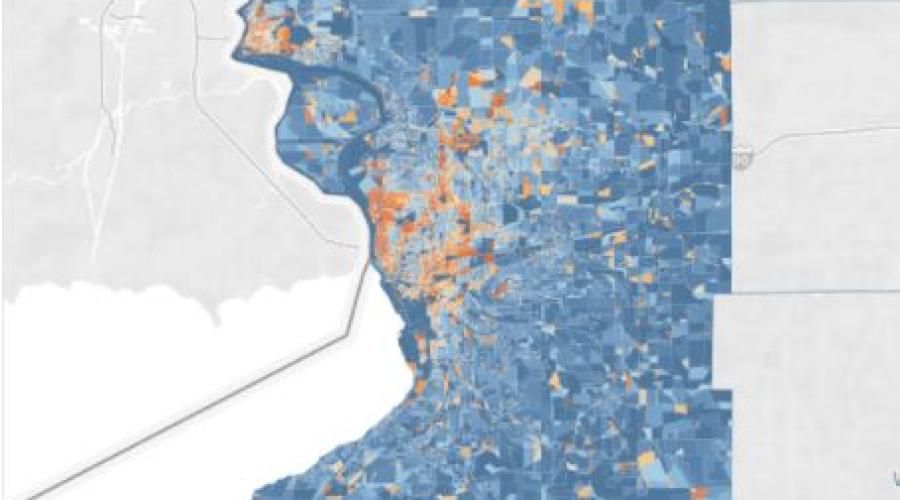
As such, Director of Research, Rusty Weaver compiled block-level data for the two county Buffalo-Niagara region into a user-friendly, interactive dashboard.